In the complex and rapidly changing world of Geographic Information Systems (GIS), PJA are experts in collecting, analysing and sharing location based information to help understand the world and predict the future to provide better, more resilient and sustainable transport outcomes.
PJA have many skilled GIS users across the transport and engineering sectors all supported by a dedicated GIS team lead by GIS Manager, Brian Norman. In recognition of GIS day we asked Brian to tell us about his journey into GIS, some of the exciting projects he’s been working on and what the future might hold:
“Having started my career as a trainee cartographer, I quickly learned to appreciate the importance of using the media of a map to tell a story. Simple things like colour schemes, symbology, labels and scale can make a big difference in the story you are trying to tell. The basics are still the same now but technology allows us to capture and share information digitally from the start of a project through to it’s completion, with the ability for all stakeholders to work collaboratively.
“I aim to ensure that the use of GIS is properly embraced to drive a project and not as an add-on to aid deliveryThe demand is high and this last year has seen our team expand with the objective of providing innovative GIS tools and techniques to support all of our projects. This has involved developing new GIS objectives for our graduates, training our staff on new techniques and embracing new technology to simplify or even automate processes which in turn allow us to spend more time on different spatially driven opportunities which may have been overlooked in the past.
“Over the past year we’ve had a variety of project highlights, from supporting local transport infrastructure projects providing an understanding of public transport and active travel accessibility to working with the team in Australia on a large data-driven pilot study to understand the potential of road speed reduction to providing high level concepts to support tourism and conservation in the Middle East, it certainly never gets boring.
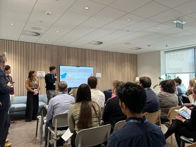
“Another huge highlight for me was PJA’s inaugral organisation-wide Transport Planning Day. We were given the opportunity to share our applications and ambitions to a 50-strong audience. This has driven discussions around new opportunities for web-based solutions, the possibilities of AI and emerging data that will help inform our movement and place strategies.
“It’s incredibly exciting and fulfilling to see the pace at which digital ways of working are developing from traditional, static reports and plans to data collection via apps, interactive digital dashboards and maps that can be directly explored to help communicate a story. The future is very promising, we have faced data challenges in the UK but the Geospatial Commission (established in 2018) is assisting. Through well driven strategy and investment it is helping to highlight the opportunities for advanced geospatial applications and how location data can be maximised to support the future of mobility and next generation transport networks. Their initiatives are driving new data sets, integrated applications and setting standards that will continue to help us to improve sustainable project outcomes through location-based insights.
“As geospatial technology rapidly develops as a prime enabler for digital ways of working, our team is here to advise on the most appropriate data, effective technical solutions and engaging deliverables to suit your project and client needs.”
Brian Norman, GIS Manager
Brian is a senior data consultant with over 25 years’ experience in the capture, analysis and integration of spatial data within transport, water and environmental projects having worked for global engineering consultancies and successfully delivered GIS solutions to national government organisations, including National Highways and the Environment Agency.
He has a successful track record as a technical manager with experience in the successful leadership and delivery of national data capture projects for public sector organisations, championing the use of location-based data to support the effective management of assets.
He has developed and led high performing teams, implemented efficient technical workflows and quality assurance procedures to share quality data across teams and organisations, improve collaboration and enable more effective planning and decision making.
Get in touch with Brian: [email protected]
Our GIS Services:
- Smart data capture tools
- Data mining and data management
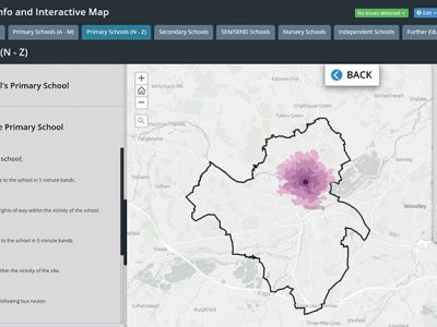
- Interactive data interrogation (web maps and apps)
- Advanced geospatial analysis
- Visualisation of complex information
Find out more about our GIS services here
Sign up for more news from PJA here