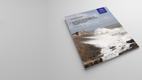
On 28th September 2021 the Welsh Government released the updated Technical Advice Map (TAN) 15 which is the first update since 2004. The updated note also replaces Technical Advice Note 14, published in 1998 regarding coastal planning.
The new guidance, due to come into effect on Wednesday 1st December 2021, has now been delayed until 2023. The update aims to move guidance from a more precautionary approach to a more risk-based approach to ensure flooding and coastal erosion are accorded appropriate consideration in plan making and development management, however, concerns from local authorities as to the implication of the new TAN-15 policy has prompted the Welsh Government to postpone the adoption of the update for two years.
However, some of the impacts of the updated TAN may make investment through development within Wales much more restrictive.
Basis
The Flood Map for Planning will become the starting point for an assessment of flood risk for any development aspirations, replacing the function of the current Development Advice Map (DAM).
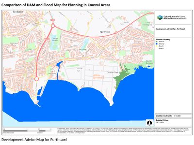
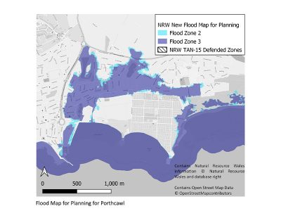
Within the Flood Map for Planning there are four new zones- Flood Zone 1, Flood Zone 2, Flood Zone 3 and a defended Zone. The crucial difference between the previous flood zone mapping in Wales and the current flood zone mapping in England is that climate change is included within the definition of the Welsh zone extents which can make significant differences, particularly within coastal areas, as shown in the images below.
The Defended Zone is defined as those areas that are served by defences with a standard level of protection of 1% AEP plus climate change fluvial risk or 0.5% AEP plus climate change tidal risk.
The Defended Zone is important for the acceptability of a development, as will be discussed below, but there is likely to be issues with the accuracy and representation of this zone in some areas, particularly where fluvial and tidal flood risk interacts.
There is also information on surface water and ordinary watercourse flood risk, coastal erosion, coastal defences and shoreline management plans within the Flood Map for Planning detailed mapping.
Suitability of development within different zones
The updated TAN lays out the suitability of all development vulnerability types within the new Flood Zones. Fundamentally, highly vulnerable development, which includes residential development, should not be proposed within Flood Zone 3 unless it is located within a Defended Zone. In terms of extent, Flood Zone 3 is considered to be similar to the previous Flood Zone 2, and the Flood Zone 2 within the English system.
The updated TAN 15 still includes the “Justification Test” and the “Acceptability of Flood Consequences” as per the previous issue, with the Justification Test largely reliant on a prospective sites’ inclusion within a Development Plan or providing strategic employment and a requirement for development to be proposed on previously developed land.
The Updated TAN can be accessed here
For more information on how this could impact your site, contact: [email protected] or find out more about our water resources services here
Sign up for more news from PJA here
[email protected]
Amy is a Chartered Environmental Consultant, Hydraulic Modeller and Project Manager with over 12 years’ experience in the water and flood risk industry. Amy’s career focus has been on project and client management in the area of hydraulic modelling and mapping, development and flood risk and surface water management. She has managed a range of hydraulic modelling projects for private and public sector clients.